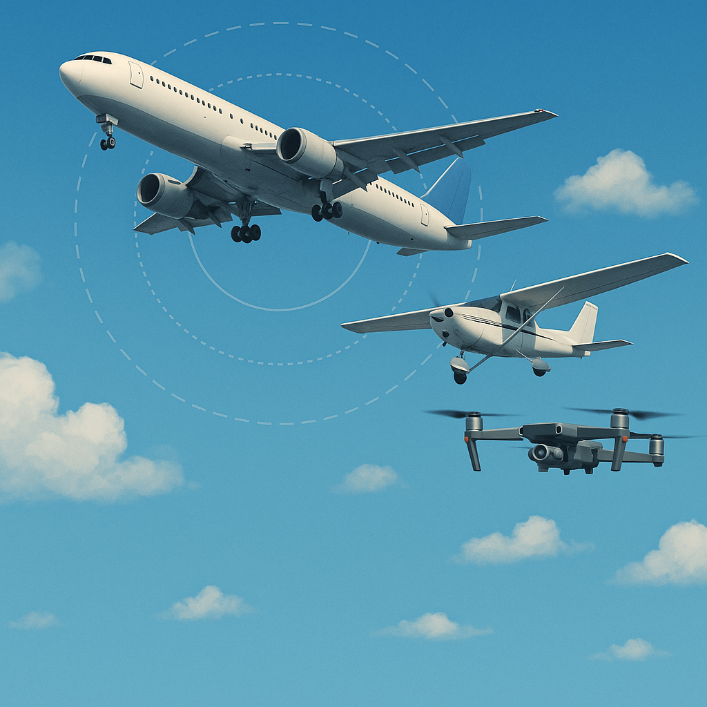
Australia’s skies are a bustling hub of activity, from massive jetliners to tiny drones buzzing over backyards. This vast airspace is meticulously managed to keep everyone safe while embracing new technologies like drones and advanced traffic systems. Whether you’re a pilot, a drone enthusiast, or just curious about what’s overhead, understanding Australian airspace is more important—and exciting—than ever.
In this guide, we’ll break down the essentials: how airspace is classified, who keeps it running, the rules for flying drones, and the cutting-edge systems set to revolutionize the skies. Plus, we’ll point you to an incredible tool to explore it all in 3D. Let’s dive in!
The Backbone of the Skies: Airspace Classes A to G
Australian airspace is split into seven classes, labeled A through G, following standards set by the International Civil Aviation Organization (ICAO). Each class defines who can fly where and how they’re managed:
Class A: High above 18,000 feet, reserved for big planes flying under Instrument Flight Rules (IFR) with strict Air Traffic Control (ATC) oversight. No casual sightseeing here!
Class C: Busy zones near airports, balancing IFR and VFR traffic. ATC directs IFR flights and guides VFR pilots with traffic updates.
Class D: Smaller airports with control towers. Pilots must radio ATC before entering—think of it as knocking before you walk in.
Class E: A hybrid zone where IFR flights get ATC help, but VFR pilots can cruise through if weather conditions allow.
Class G: The wild west of airspace—uncontrolled and common in rural areas. Pilots handle their own navigation, and it’s where most drone flights happen.
For drone operators, Class G is your playground—just stick to the rules, and no ATC clearance is needed. Understanding these classes helps you know where you can fly and why the system works the way it does.
Who’s in Charge? Managing Australian Airspace
Two powerhouse organizations keep Australia’s skies humming:
Airservices Australia: The air traffic pros. They manage ATC, set temporary airspace restrictions (like during bushfires), and ensure planes don’t bump into each other.
Civil Aviation Safety Authority (CASA): The rule-makers. CASA sets safety standards for all aircraft—planes, helicopters, and drones alike.
In controlled airspace (A-E), ATC calls the shots. In Class G, it’s up to pilots to stay safe, with optional guidance from Airservices. As drones soar in popularity, these groups are teaming up to weave them into the airspace fabric without a hitch.
Drone Rules: Flying Smart and Safe
Drones are everywhere, but they come with responsibility. CASA’s regulations depend on whether you’re flying for fun or profit.
Recreational Drone Basics
Flying for fun? Here’s what you need to know:
Height Limit: Stay below 120 meters (400 feet) Above Ground Level (AGL).
Eyes on the Prize: Keep your drone in visual line of sight (VLOS)—no binoculars or screens.
No-Go Zones: Stay 5.5 kilometers (3 nautical miles) from controlled airports and avoid populated areas, crowds, or emergency scenes.
Time and Weather: Fly during the day and in good weather only.
Privacy First: Don’t record people without permission.
Break these rules, and you could face hefty fines. Check CASA’s drone page for the latest.
Where Drones Fit In
Class G: Your go-to for drone flights. No ATC needed—just follow CASA’s rules.
Controlled Airspace (A-E): Flying near airports or above 120m? You’ll need CASA approval and possibly ATC coordination.
Leveling Up: RePL and ReOC
For serious drone ops—like aerial photography or deliveries—you’ll need:
Remote Pilot Licence (RePL): Training to fly commercially, use bigger drones (over 2kg), or operate in tricky areas.
Remotely Piloted Aircraft Operator’s Certificate (ReOC): A business license for advanced missions, like flying beyond visual line of sight (BVLOS).
Both mean training and certification, but they open doors to incredible opportunities.
Decoding Height: AGL vs. AMSL
Height matters, and drones and planes measure it differently:
AGL (Above Ground Level): Height from the ground beneath you. Drones use AGL because their sensors track altitude from takeoff, perfect for staying low.
AMSL (Above Mean Sea Level): Height from sea level, used by planes for consistent navigation over hills and valleys.
Imagine flying at 120m AGL on a 300m AMSL hill—your drone’s at 420m AMSL. CASA picked 120m AGL as the drone ceiling to keep them below most manned aircraft, reducing collision risks. It’s a global sweet spot for safety and flexibility.
Staying Under 120m: Tips for Drone Pilots
Trust Your Tech: Most drones display AGL on their apps—watch it closely.
Eyeball It: Use landmarks—trees (10-20m) or poles (8-12m)—to gauge height.
Mind the Terrain: Adjust over hills to keep AGL below 120m.
App Up: Tools like OpenSky flag when you’re pushing the limit.
Radio Frequencies You Need to Know
Australian airspace uses specific frequencies to keep pilots and air traffic control (ATC) in sync. Here’s what RePL drone pilots should understand about each:
Common Traffic Advisory Frequency (CTAF)
What it is: CTAF is the go-to frequency at non-towered airports, where no control tower is active. It lets pilots talk directly to each other to manage takeoffs, landings, and nearby movements.
How it’s used: Pilots announce their plans on CTAF—often starting 10 nautical miles out—to keep everyone in the loop.
For drone pilots: Even if you’re not transmitting, tuning into CTAF when operating near a non-towered airport (within 3 nautical miles) helps you track manned aircraft and avoid surprises.
Class D Tower Frequencies
What it is: These frequencies are used in Class D airspace, which surrounds smaller airports with control towers. They connect pilots to ATC for real-time coordination.
How it’s used: Before entering Class D airspace, pilots must contact the tower via the Class D frequency to get clearance and instructions.
For drone pilots: If your operation nears Class D airspace, you’ll need CASA approval and possibly ATC coordination. An AROC lets you communicate directly with the tower when required.
Flight Information Area (FIA) Frequency
What it is: Known as the “area frequency,” this is used in Class C airspace around major airports, linking pilots to radar operators who manage traffic separation.
How it’s used: Pilots use the FIA frequency to stay in touch with ATC in busy, controlled zones.
For drone pilots: Flying in Class C airspace is rare for drones and needs special permissions, but knowing this frequency is handy if you’re operating nearby.
The Aviation Radio Operators Certificate (AROC)
RePL pilots in Australia get the Aviation Radio Operators Certificate (AROC) as part of their training, and it’s your key to using airband frequencies legally.
Why it matters: The AROC equips you with the skills to use radio protocols and talk to ATC or other pilots when flying in controlled or shared airspace.
How you get it: Most RePL courses include AROC training, so you’ll earn it alongside your licence. If not, you can take a separate course from a CASA-approved provider.
What it unlocks: With an AROC, you can transmit on frequencies like CTAF or Class D Tower frequencies to coordinate your drone flights, request clearances, or alert others to your position.
Tips for RePL Pilots Using Radio
Here’s how to leverage radio communication as a drone pilot:
Listen to CTAF: Near non-towered airports, monitor the frequency to stay aware of manned aircraft activity.
Find the right frequency: Use the Enroute Supplement Australia (ERSA) or aviation charts to pinpoint CTAF, Class D, or FIA frequencies for your area.
Talk when needed: With an AROC, use the appropriate frequency to communicate with ATC or pilots if your operation requires it.
Check NOTAMs: Before flying, review Notices to Airmen (NOTAMs) for any frequency updates or airspace changes.
Navigation Tools for the Skies
Pilots rely on:
Aeronautical Charts: Maps showing airspace boundaries, altitudes, and frequencies.
Electronic Flight Bags (EFBs): Apps on tablets with real-time GPS and weather data.
For drone operators, grab:
Visual Terminal Charts (VTCs): Close-up maps near airports, highlighting no-fly zones, points out golf courses.
Visual Navigation Charts (VNCs): Big-picture maps for rural flights.
Find these at Airservices Australia or in drone apps.
The Drone Revolution: FIMS and UTM
Big changes are coming with two game-changing systems:
Flight Information Management System (FIMS): Set for November 2025, FIMS links traditional aviation with drones, sharing live airspace data through providers like AvSoft and OneSky.
Uncrewed Traffic Management (UTM): A wider net that includes FIMS, managing low-altitude drone traffic with flight planning and collision avoidance.
Think drone deliveries, medical drops, and farm surveys—by 2043, Australia could see 60 million drone flights a year, all thanks to these systems.
A Quick History Lesson
Airspace classes didn’t just appear—they evolved:
1920s-1930s: Aviation boomed, but rules were a mess.
1944 Chicago Convention: ICAO standardized the A-G system in the 1950s.
Australia: Jumped on board early, adapting as tech like radar—and now drones—came along.
It’s a story of keeping up with the times, and drones are the next chapter.
Take Flight with the Airspace Visualizer
Australian airspace is a marvel of coordination and innovation, balancing old-school aviation with the drone age. Ready to see it for yourself? The Australian Airspace Visualizer lets you explore it all in 3D—airspace classes, restricted zones, and more. It’s a must for pilots, drone operators, and anyone who loves the skies.
Fly safe, stay curious, and embrace the future of Australian aviation!
Check Airspace Restrictions
Access Australian airspace data with live plane tracking and detailed information about airspace shapes and restrictions.
Open Airspace Tool